Category:Utah State Route 161
Jump to navigation
Jump to search
 | number: | (one hundred sixty-one) |
|---|---|---|
| State highways in Utah: | 141 · 142 · 143 · 144 · 145 · 146 · 147 · 148 · 149 · 150 · 151 · 152 · 153 · 154 · 155 · 156 · 157 · 158 · 159 · 160 · 161 · 162 · 163 · 164 · 165 · 166 · 167 · 168 · 169 · 170 · 171 · 172 · 173 · 174 · 175 · 176 · 177 · 178 · 179 · 180 · 181 |
state highway in Millard County, Utah, United States  | |||||
| Upload media | |||||
| Instance of | |||||
|---|---|---|---|---|---|
| Location | Millard County, Utah | ||||
| Transport network | |||||
| Owned by | |||||
| Maintained by | |||||
| Inception |
| ||||
| Length |
| ||||
| Terminus | |||||
| |||||
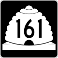
English: Media related to Utah State Route 161, a 3.084-mile (4.963 km)state highway in the southeastern corner of Millard County, Utah, United States, that connects Interstate 70 (Exit 1) with Interstate 15 (Exit 135), by way of Cove Fort.
Subcategories
This category has only the following subcategory.
Media in category "Utah State Route 161"
The following 3 files are in this category, out of 3 total.
-
 Utah 161.svg 750 × 600; 73 KB
-
 Utah SR 161 map.svg 1,475 × 860; 301 KB
-
 Utah SR 161.svg 385 × 385; 7 KB
